Administrative boundaries
UNICEF uses administrative boundaries (or administrative areas) to define geographic areas in MagicBox and related projects. Administrative boundaries (ABs) extend the concepts of a country, state, or region. Examples of an administrative boundary may be…
- Country
- State
- Province
- County
- Municipality
- And more…
ABs come from GADM and the Humanitarian Data Exchange (HumData), databases of global administrative areas. In addition, more ABs may come from other sources like municipal governments. These databases make it easier to work with this data in GIS or related software.
Levels
Levels are a hierarchy system to explain different concepts of administrative boundaries. For example, a city may belong to a municipality, which belongs to a country. Levels help us explain this hierarchy.
UNICEF uses this system of levels:
- Level 0: Countries
- Level 1: States
- Level 2: Counties
- Level 3: Municipalities
- And so on…
Why we use them
Different definitions of geographic areas by different nations makes worldwide geographic mapping a challenge.
Not everyone uses the same names for regions.
In MagicBox projects, each region, or shape, is assigned an admin_id.
An admin_id is an interpretation of a political border for a specific time.
They point to a specific shape in a shapefile that represents an individual country.
Time is a part of the admin ID to ingest historical data.
For example, mobility or temperature might require a series from an earlier date where a region was known by a different name.
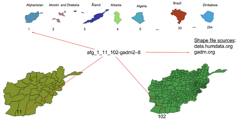
See the following example of an AB for Afghanistan, with an admin_id.
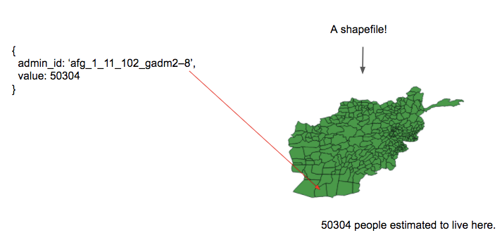
Example of an administrative boundary for Afghanistan
To understand where afg_1_11_102-gadm2–8 points to, note that Afghanistan has three levels of administrative boundaries.
The admin_id has three integers, one per admin level:
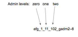
Afghanistan has three levels of administrative boundaries
Naming string explained
First integer
The first integer is 1 because Afghanistan is the first country in GADM’s database.
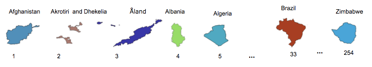
The first few countries in GADM’s database
Second and third integer
Afghanistan has 34 shapes at level one and 320 shapes in level two.
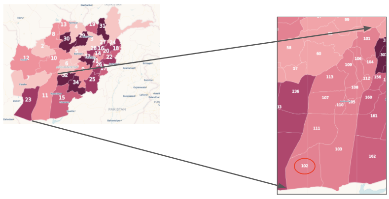
Afghanistan: Higher level administrative boundaries
Putting it together
Thus, afg_1_11_102-gadm2–8 indicates any population value attached to it is related to:
- First country in the gadm collection
- 11th shape in the admin level 1 shapefile
- 102nd shape in the admin level 2 shapefile
Putting it together: What the admin ID represents